Groundwater is our most important source of freshwater but is coming under increasing pressure due to drought and pollution. With a multidisciplinary team, we provide an integrated view of broad groundwater issues and search for sustainable and efficient solutions together with our clients. To do so, we use model calculations, set up sensor networks and interpret measurements of groundwater levels and quality.
- Advice on groundwater management and groundwater extraction
- Mapping of flow paths for point source and diffuse pollution
- Establishing models for groundwater flow, groundwater recharge and solute transport from chemical contaminations
- Set-up and advice on sensor networks
Importance of groundwater
Groundwater is our largest freshwater resource and must therefore be managed with care. In addition to direct water use through groundwater extraction, groundwater also has many other functions. For instance, groundwater is essential for groundwater-dependent eco-systems and contributes as a major source of water for streams and rivers.
Groundwater extraction and reclamation
Our clients often seek advice on (additional) groundwater withdrawals or the impact of quarrying activities on groundwater. For many years, VITO has been modelling the effects of extractions in the Campine region (northeastern Belgium) on the local hydrogeology. In addition, VITO is a permanent partner of the drinking water companies in Flanders for the modelling of the impact of groundwater withdrawals.
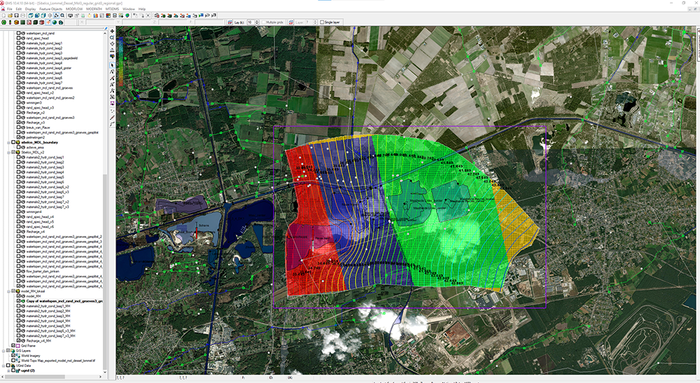
Groundwater flow models
We use groundwater flow models supplemented with the latest geological insights and hydrological information. We prefer to feed the model results with data from local sensor networks. This allows us to map the groundwater management challenges, the impacts of drought and the impact of groundwater abstraction, in detail on both regional and local scales.
Our groundwater modelling expertise focuses mainly on projects in complex environments or where customised studies are required. We also study the impact of climate change, drainage, land management and land use on the groundwater system as part of research projects.
Solute transport models
The groundwater flow models also allow us the simulation of flow paths of point and diffuse sources of groundwater pollution. For example, we developed a tool on behalf of the Flemish Environment Agency (VMM) to visualise the vulnerability of drinking water abstractions to pesticides. For this purpose, solute transport models for the unsaturated zone were linked to groundwater flow models in an innovative way.
Groundwater recharging models
To simulate water transport in the unsaturated zone, we mostly use conceptual water balance models such as WetSpaSS and WetSpa or physically-based models such as Hydrus or SWAP, depending on the demand.
With these models, we can calculate groundwater recharge taking into account precipitation, soil properties, and groundwater depth. We also use these models as a basis for transport and leaching behaviour of pollutants (including heavy metals, PFAS and pesticides).
In addition, these models can also provide insight into the evolution of droughts. They allow simulations of soil conditions during prolonged periods without precipitation and the impact of drought on groundwater recharge.
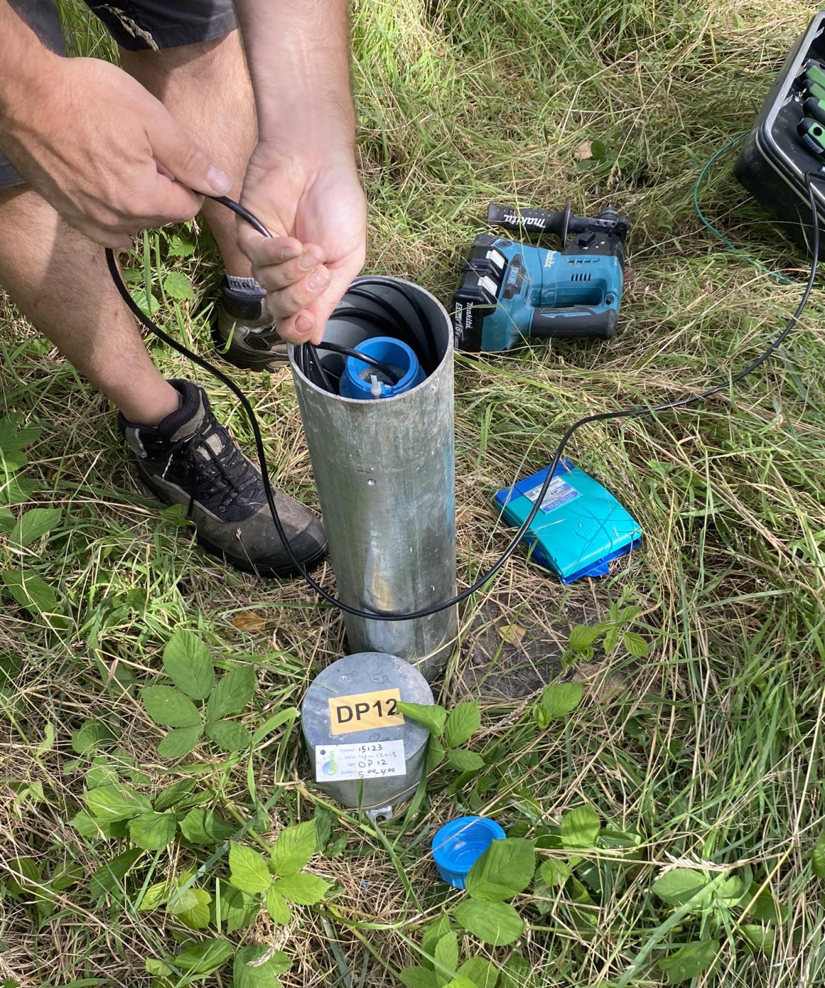
Sensor networks
Sensor networks are a particularly valuable addition to our models when we want to understand local or regional hydrogeology. In-situ data can be used to better map groundwater levels and flows. The measured data are also needed for reliable calibration and validation of our groundwater models.
In our team, we also have expertise in setting-up real-time groundwater networks. Such networks offer timely data on groundwater levels, quality parameters, and other relevant variables. This helps in better understanding groundwater dynamics and enables prompt decision-making. In addition, these networks automate the data collection process, reducing the need for frequent field visits and associated costs. The collected measurement data are conveniently presented in a dashboard, allowing water managers, policymakers and researchers to analyse trends and patterns in the data.
VITO also offers its expertise in setting up a sensor network for both groundwater and surface water. We advise our customers on the selection, type of sensors and determining the ideal location and depth of the sensors.