Michiel Maertens is a hydrologist in VITO's Digital Water team. His expertise is in mapping groundwater flow, soil moisture and pollutant transport with numerical models and data from sensor networks. Michiel received his PhD in 2021 where he worked on satellite observations (of soil moisture) and hydrological models. In this blog, Michiel explains how soil moisture can be observed from space and possible applications. Within VITO, experts in hydrology and remote sensing work closely together as part of the Terrascope services.

Why soil moisture?
Soil moisture refers to the water content in the top layer of the soil and describes how wet or dry the soil is. It is an important variable for plant growth and - together with precipitation and evaporation - a basic component of the hydrological cycle.
The amount of water stored in the soil, therefore depends largely on climatic factors. In addition, human factors such as irrigation or the construction of drainage networks can also influence soil moisture.
Box 1 shows that soil moisture is not to be confused with groundwater. However, both are in close contact with each other. The rate of groundwater recharge depends strongly on the amount of water in the soil.
Measuring and monitoring soil moisture is not always easy. The most reliable information can be obtained from in situ data (e.g., by installing a sensor at specific locations). Such sensors provide the most reliable and accurate data on temporal variations in soil moisture. They can also measure soil moisture at different depths.
Obtaining data from in situ networks is challenging and expensive due to high installation and maintenance costs. In addition, the sensors typically measure only at a very local scale (usually 5-10 centimeters around the sensor) so these measurements are not always representative at a larger scale.
Box 1: Soil moisture versus groundwater
Soil moisture is the water contained in the pores between soil particles, above the groundwater table (the unsaturated zone). In addition to water, air is also containedin these pores. Below the groundwater table (the saturated zone), the soil is completely saturated with water and there is no air present in the pores.
Soil moisture content fluctuates throughout the year due to precipitation, evaporation and twater consumption by plants during the growing season. How much soil moisture varies depends on different factors such as soil type, groundwater depth, and vegetation. If the soil contains sufficient water, it can percolate to groundwater, replenishing groundwater reserves.

Satellite observations over Belgium
Due to technological innovations, it is now possible to observe soil moisture from space. There are several satellites orbiting our planet that monitor the Earth's surface with a radar instrument or radiometer. These instruments record microwaves emitted (radiometer) or reflected (radar) from the top 5 centimetres of the soil.
The signal varies with the amount of water in the soil. Soil moisture is derived from this microwave signal using multiple algorithms. The main advantage of microwave observations is that they are not hindered by clouds and can collect data at night. This allows the collection of continuous time series of soil moisture on a continental scale.
The information allows the understanding of soil moisture dynamics over large areas. For example, Figure 1 shows an animation of soil moisture (at 10 cm depth) in Belgium for the period March-June 2022. The data are derived from the Copernicus Soil Water Index product and show the amount of water in the pores, expressed as a percentage (see box 2). Detecting spatio-temporal variations in soil moisture are of great importance as soil moisture has a strong impact on agricultural productivity and ecosystem health.
Figure 1: Animation of the Copernicus Soil Water Index for the period March-June 2022, with a spatial resolution of 1 km (double-click to start animation)
In addition, the data can also provide important insights into spatial and temporal patterns of e.g. (hydrological) drought. Figure 2 shows the average soil moisture anomaly (deviation) for the months of June and August 2022 compared to the average soil moisture in the same month calculated over the period 2015-2022. The blue colour means that the soil is wetter than normal, red indicates a drier soil than normal. The figure shows that the soils in Flanders were not yet unusually dry in June 2022. Because of a reasonable amount of precipitation during that month, the upper soil layers contained enough water. However, the following extremely dry summer months resulted in completely dry soils in August and much drier conditions than average.
![]()
Figure 2: Deviation of soil moisture in June and August 2022 from the average soil moisture for those same months (calculated over the period 2015-2022)
Obviously, uncertainties and errors are inherent in soil moisture estimates from space. Therefore, comparing satellite-observed soil moisture with on-site observed measurements (via soil moisture sensors) remains crucial to develop reliable applications.
Figure 3 shows a time series of soil moisture measured in Overpelt and Liedekerke with an in-situ sensor (coloured in blue– data obtained from the Flanders Environment Agency) and with a satellite (coloured red). The grey bars show the daily precipitation. The figure shows that the satellite and sensor-measurements yield fairly similar soil moisture estimates, although satellite observations tend to overestimate soil moisture during the summer months.
![]()
Figure 3: Time series of the daily satellite-observed soil moisture (Copernicus SWI) versus in situ soil moisture (VMM sensors) at 10 cm depth for the period 2015 - August 2022 at Overpelt and Liedekerke. The grey bars show the daily precipitation.
Box 2: Copernicus Soil Water Index
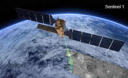
The Copernicus Soil Water Index (SWI) product shows the saturation level of the soil, expressed in %. The product has a spatial resolution of 1 km and uses microwave radiation measured by the Sentinel-1 satellite. The satellite observations are assimilated into a hydrological model to produce daily soil moisture estimates on a European scale and at various depths. The resulting product achieves a both high temporal and spatial resolution, allowing the increased hydrological use of radar data for various applications.
Applications
The rapid development of techniques and algorithms for deriving soil moisture from microwave signals has led to more reliable, high-resolution estimates of soil moisture. Such data have the potential to become an important source of information for hydrological research, water management and agricultural applications. To date, satellite-based soil moisture estimates have been used primarily in a scientific context. Applications for commercial or public use are still relatively limited.
Satellite-observed estimates of soil moisture in combination within situ measurements of groundwater levels, can contribute to a better knowledge of hydrological processes in the subsurface. This, in turn, can lead to more efficient and effective water management. Soil moisture largely determines the groundwater recharge. Combining satellite-based soil moisture and local groundwater measurements could allow us to scale up the groundwater level measurements to a regional scale (from point measurements to regional-scale groundwater levels). This could contribute to a better knowledge of hydrological processes, and, in particular the hydraulic properties of soil and subsoil. This in turn can lead to more efficient and effective water management.
Satellite-based measurements of soil moisture could also be relevant for agricultural use. Plants extract their water primarily from the soil. Soil moisture estimates can be important at both global and local scales to estimate drought-induced crop stress and to support specific management decisions. Detailed, reliable, and timely information on the current state of the soil can therefore be useful in deciding when to irrigate fields or where and when to sow and harvest.